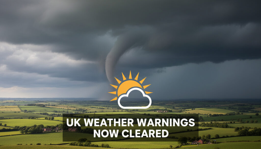
UK Weather Tornado Warning – No Active Alerts Today
No tornado warnings are currently active across the United Kingdom, according to the Met Office, BBC Weather, and the Tornado and Storm Research Organisation. While public searches for severe rotational storms have increased, the immediate threat concerns Storm Dave, a rapidly deepening low-pressure system bringing disruptive winds from Saturday evening through Easter Sunday morning.
Yellow wind warnings are now in effect for multiple regions ahead of the Easter weekend, with forecasters predicting peak gusts of 50 to 60 mph widely, and potential highs of 80 to 90 mph in exposed coastal areas. The absence of tornado-specific alerts highlights the distinction between general severe weather and the specialized atmospheric conditions required for funnel cloud formation.
Current guidance emphasizes wind-related hazards rather than tornadic activity, though the dynamic nature of Atlantic weather systems warrants continuous monitoring of official channels.
Is There a UK Weather Tornado Warning Today?
Meteorological authorities confirm no tornado warnings are active for today. The Met Office has issued no red or amber alerts of any classification, while the BBC Weather service aligns with these findings. The Tornado and Storm Research Organisation (TORRO) similarly reports no active outlooks for severe thunderstorms capable of producing tornadoes, large hail exceeding 20mm, or non-tornadic gusts above 55 mph.
No warnings active
Storm Dave wind warnings
Medium impact, low likelihood winds
Continuous monitoring via Met Office
- No tornado, thunderstorm, or snow warnings are currently issued by official UK weather services
- Storm Dave represents the only named storm system affecting the country
- Yellow wind warnings indicate potential for 50-60 mph gusts widely
- TORRO discontinued regular forecasting operations after two decades
- Severe thunderstorms remain possible within broader frontal systems but are not currently forecast
- Traffic Scotland and regional authorities reference general Met Office guidance
- Long-range patterns suggest changeable Atlantic conditions through Easter
| Weather Aspect | Current Status | Authority |
|---|---|---|
| Tornado Warnings | None active nationwide | Met Office |
| Thunderstorm Warnings | No alerts issued | Met Office / TORRO |
| Snow Warnings | None active; wintry showers possible on high ground only | Met Office |
| Storm Dave Status | Yellow wind warning April 4-5 | Met Office |
| Peak Wind Gusts | 50-60 mph widely; 80-90 mph slight chance in exposed areas | Met Office |
| TORRO Forecasts | Ceased after 20 years due to media overhyping concerns | TORRO |
| Warning Color Code | Yellow (medium impact, low likelihood) | Met Office |
| Affected Regions | Central Scotland, Northern Ireland, North East England | Met Office |
| AccuWeather Severe Map | No specific UK alerts matching tornado criteria | AccuWeather |
UK Weather Tornado Warning Tomorrow?
Tomorrow brings the arrival of Storm Dave, though this system poses wind rather than tornadic hazards. The low-pressure center will track northeastwards across northwestern UK during Saturday evening, clearing to the North Sea by Easter Sunday. Forecasters emphasize that while the atmosphere will be highly dynamic, the specific shear and instability parameters required for tornado development are not currently present.
Strong west to southwesterly winds will develop Saturday night into Easter Sunday morning. Expect delays to road, rail, air and ferry services, possible bridge closures, power cuts affecting mobile coverage, and large waves on windward coasts.
Regional Impact Zones
Three primary regions face yellow wind warnings. Central, Tayside and Fife will see impacts across Angus, Clackmannanshire, Dundee, Falkirk, Fife, Perth and Kinross, and Stirling. Northern Ireland faces warnings covering County Antrim, Armagh, Down, Fermanagh, Londonderry, and Tyrone. North East England includes Darlington, Durham, Gateshead, Newcastle upon Tyne, Northumberland, and Sunderland.
Timing and Duration
The strongest winds are expected overnight Saturday into Sunday morning, easing gradually through Sunday afternoon as the system exits into the North Sea. Some northwesterly winds will persist into Sunday, though with decreasing intensity. Uncertainty remains regarding the exact path and intensity of the low-pressure center.
What Does the Met Office Say About UK Tornado Warnings?
The national weather service maintains rigorous criteria for issuing tornado-specific alerts, distinct from general wind warnings. Current atmospheric analysis indicates no supercell development or mesocyclone activity that would warrant tornadic watches. The TORRO forecast page reflects this assessment, showing no severe thunderstorm outlooks.
Yellow warnings indicate medium impact events with low likelihood. Red warnings, which would signify dangerous weather requiring immediate action, are not anticipated. The Met Office has not mentioned tornadoes, snow, or thunderstorms in current briefings, focusing instead on wet, windy Atlantic fronts.
Distinction Between Wind and Tornado Alerts
Straight-line wind damage differs fundamentally from tornadic rotation. Current models suggest damaging gusts will result from pressure gradients within the extratropical cyclone rather than convective updrafts. This distinction explains why warning systems prioritize wind over tornado preparedness for the current Easter weekend period.
Official Communication Channels
Real-time updates appear on the Met Office warnings portal, with BBC Weather providing complementary coverage. Netweather issues watches only when severe weather becomes likely, currently showing no active alerts for thunderstorm or tornado conditions.
Current Thunderstorm and Tornado Forecasts for the UK?
Broader forecast patterns indicate changeable conditions extending beyond the immediate Easter weekend. Atlantic fronts will continue bringing rain and showers, heaviest in western and northwestern regions, with near-average temperatures and possible wintry showers on high ground. Storm Goretti Snow Warning – Alps Alerts and Forecast provides context for European severe weather patterning that occasionally influences UK systems.
While TORRO no longer produces regular forecasts, severe weather monitoring continues through the Met Office and Traffic Scotland for regional travel impacts. Check live updates rather than relying on historical forecast archives.
Cessation of TORRO Forecasting
The Tornado and Storm Research Organisation ceased producing forecasts after two decades of operations, specifically citing concerns regarding media overhyping of severe weather risks. This development shifts the primary responsibility for severe thunderstorm and tornado monitoring entirely to governmental meteorological services.
Long-Range Outlook
Extended forecasts suggest periods of strong winds will continue through the coming weeks, interspersed with short warm spells in southern and eastern areas. No specific thunderstorm warnings are active, though convective available potential energy (CAPE) values will be monitored for late-spring developments.
When Will Storm Conditions Peak?
- : No severe weather warnings active. Preparatory conditions for Storm Dave.
- : Storm Dave arrives from the Atlantic. Winds strengthen across northwestern regions.
- : Peak wind speeds occur. Gusts of 60-70 mph in exposed areas, with slight chance of 80-90 mph on coasts and hills.
- : Winds gradually ease as the low clears to the North Sea. Some northwesterly winds persist.
- : Changeable Atlantic patterns continue with rain, showers, and intermittent strong winds.
What Do Forecasters Know for Certain?
| Established Information | Uncertain Elements |
|---|---|
| No tornado warnings are active from Met Office, BBC, or TORRO | Potential for isolated severe cells within frontal boundaries |
| Storm Dave will produce defined yellow wind warnings | Exact wind speeds at specific coastal locations |
| Peak gusts will reach 50-60 mph widely | Duration of 80-90 mph gusts in most exposed spots |
| TORRO has discontinued regular forecasting operations | Long-range thunderstorm potential beyond mid-April |
| Easter weekend will be wet, windy, and colder than average | Precise tracking of subsequent Atlantic lows |
How Common Are UK Tornadoes?
The United Kingdom typically experiences 30 to 50 tornadoes annually, though most are weak and short-lived compared to North American counterparts. These events usually occur within severe thunderstorm cells during unstable summer conditions rather than within large-scale winter windstorms. UK Heatwave Sleeping Arrangements – Tips for Cooler Nights offers context for the summer convective season when tornado risk historically increases.
Storm naming conventions like Dave follow established meteorological criteria for medium-impact events. Previous named systems have generated similar public inquiry regarding tornado potential, though the UK rarely experiences the violent tornadoes associated with Tornado Alley regions. The current Easter period typically favors wind and rain systems over convective tornadic storms. While the current Easter period favors wind and rain systems over convective tornadic storms, you can check Поточні скасування рейсів TUI for current TUI flight cancellations.
Official Sources and Expert Guidance
Strong west to southwesterly winds will develop Saturday night into Easter Sunday morning, with a slight chance of injuries and danger to life from flying debris and large waves on coasts.
Met Office Warning Service
After 20 years of severe weather forecasting, TORRO has ceased producing regular outlooks due to concerns regarding media overhyping of meteorological risks.
Tornado and Storm Research Organisation
Summary of Current Weather Alerts
No tornado warnings are currently active across the United Kingdom. Storm Dave presents the primary severe weather concern through Easter Sunday, with yellow wind warnings affecting Central Scotland, Northern Ireland, and North East England. Residents should prepare for disruptive travel conditions and potential power interruptions rather than tornadic activity, monitoring official Met Office channels for rapid forecast updates.
Frequently Asked Questions
Are there any snow warnings for the UK today?
No snow warnings are currently active. Wintry precipitation is limited to possible showers on high ground in northwestern hills, with no accumulations expected at lower elevations.
Why has TORRO stopped issuing tornado forecasts?
The organisation ceased regular forecasting operations after 20 years, citing concerns that media outlets were overhyping severe weather risks and creating unnecessary public alarm.
What is the difference between a yellow wind warning and a tornado warning?
Yellow wind warnings indicate medium impact events with low likelihood, covering broad areas for straight-line winds. Tornado warnings require specific radar indications of rotational activity and are issued for localized, immediate threats.
Will thunderstorms accompany Storm Dave?
No thunderstorm warnings are currently issued. Storm Dave is primarily a wind and rain event driven by pressure gradients rather than convective instability.
How should I prepare for the Easter weekend winds?
Secure loose garden objects, anticipate travel delays, charge mobile devices, and avoid coastal paths during peak wind periods on Sunday morning.
Where can I find live tornado warning updates?
The Met Office warnings portal provides real-time alerts. While tornadoes are rare in the UK, any severe weather warnings would appear there alongside general storm updates.
More related posts
 Al Murray Biography: From Pub Landlord to Historian
 Band 6 NHS Pay 2024: Scales, Increments & Roles
 Paula Wilcox: Age, Husband, Children, and Career
 Dawood Ibrahim: Family, Criminal Empire, and Pop Culture
 iPhone Pro Max 16 – UK Prices, Deals and Specs
 Mark Feehily: Westlife Singer’s Health Update and Family Life
 Mother’s Day USA 2025: Date, History & UK Differences
 Cast of Sister Boniface Mysteries – Full List Seasons 1-5
