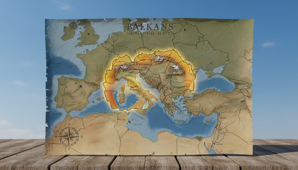
Where Is North Macedonia – Location Map Borders Key Facts
North Macedonia sits in the heart of the Balkan Peninsula, a landlocked nation in Southeast Europe bordered by five countries. Officially renamed from “Macedonia” in January 2019 following the Prespa Agreement with Greece, this republic occupies a strategic position between the Adriatic and Aegean seas.
The country spans approximately 25,713 square kilometers of mountainous terrain, with its capital Skopje positioned in the northern region. Its coordinates place it firmly within the Northern and Eastern hemispheres, serving as a crucial transit corridor connecting Greece to Central Europe through the Balkan corridor.
Where Is North Macedonia Located?
Southeast Europe, Balkans
Skopje
25,713 km²
~2.08 million
- Landlocked position between Greece and Serbia with no direct sea access
- Renamed January 2019 to resolve the longstanding naming dispute with Greece
- Coordinates span latitudes 40° to 43° N and longitudes 20° to 23° E
- Shares land borders totaling approximately 748 kilometers with five neighbors
- Contains Lake Ohrid, one of Europe’s oldest and deepest lakes
- Occupies the northern third of the broader historical Macedonia region
- Serves as a key transit route for goods traveling from Greece through the Balkans
| Fact | Details |
|---|---|
| Official Name | Republic of North Macedonia |
| Continental Position | Southeast Europe |
| Approximate Center | 41.77°N 21.70°E |
| Total Area | 25,713 km² (9,928 sq mi) |
| Population (2017) | 2,084,367 |
| Capital City | Skopje (northern region) |
| Bordering Countries | 5 (Serbia, Kosovo, Bulgaria, Greece, Albania) |
| Total Border Length | ~748 km |
| Administrative Divisions | 80 municipalities, 1 city (Skopje) |
| Major Lakes | Ohrid, Prespa, Dojran |
What Countries Border North Macedonia?
North Macedonia shares its boundaries with five nations, creating a complex geopolitical perimeter that has shaped its history and trade relationships. The total land border extends roughly 748 kilometers, with varying lengths and terrain characteristics along each frontier.
Northern and Western Frontiers
To the north, a 62-kilometer boundary separates North Macedonia from Serbia, while the northwestern edge touches Kosovo for 159 kilometers. The western border with Albania runs 151 kilometers through mountainous terrain, marked by the Lake Ohrid and Lake Prespa regions that straddle both nations.
Southern and Eastern Limits
The southern frontier with Greece represents the longest single border at 228 kilometers, extending across varied topography including the broader Macedonia region. To the east, the 148-kilometer boundary with Bulgaria completes the perimeter, situated along the Osogovo and Malesevski mountain ranges.
The Greek border accounts for roughly 30% of North Macedonia’s total boundary length, while the Kosovo border represents approximately 21%. These frontiers follow natural geographic features including the Šar Mountains and the Vardar River valley system.
What Are Key Geographic Facts About North Macedonia?
Topography and Terrain
The landscape features an elevated plateau punctuated by rolling hills and deep valleys. Rugged mountain ranges dominate the horizon, including the Šar Mountains along the northwestern border with Kosovo and Albania, the Osogovo and Osogovski ranges in the northeast, and the Malesevski and Nidže ranges in the east. These elevations frame the central Vardar River valley, which serves as the country’s primary geographic and economic corridor.
The terrain sits significantly above sea level throughout most of the country, with deep valleys cutting through elevated plateaus. The Šar Mountains and adjacent ranges create natural boundaries that have historically influenced settlement patterns and transportation routes.
Hydrology and Major Lakes
Three significant lakes define the southern periphery. Lake Ohrid and Lake Prespa sit on the borders with Albania and Greece, while Lake Dojran marks the southeastern frontier with Greece. These water bodies represent critical ecological zones and lie within the broader Macedonia region that extends across North Macedonia, north-central Greece, and southwestern Bulgaria, covering approximately 67,100 square kilometers total.
While the country primarily falls between longitudes 20° and 23° E, a small eastern territory extends slightly beyond 23° E. The latitudinal range of 40° to 43° N places the nation in the temperate climate zone of the Northern Hemisphere.
How Did North Macedonia’s Status Evolve?
-
Declared independence from the former Yugoslavia, establishing sovereignty over the current territory with Skopje as capital.
-
Officially renamed from “Republic of Macedonia” to “Republic of North Macedonia” following ratification of the Prespa Agreement, distinguishing it from the Greek region of Macedonia.
Source: Geology.com
What Is Definitively Established About Its Position?
Confirmed Information
- Exact land border demarcations with all five neighbors totaling 748 km
- Precise coordinates: 40°-43°N latitude, 20°-23°E longitude
- Official area measurements: 25,713 km² (primary figure)
- Capital location: Skopje, northern sector
- Name change finalized January 2019; no ongoing territorial disputes
Remaining Uncertainties
- Population figures pending updated census (last official count: 2017)
- Minor variations in area calculations (some sources cite 25,436 km²)
- Precise demographic distribution in border municipalities
Why Does This Location Matter?
North Macedonia’s position on the Balkan Peninsula places it east of Italy, separated by the Adriatic Sea. This geographic reality has established the country as a vital transit route for commercial goods moving from Greek ports northward through the Balkans into Central and Western Europe. The Secrets Lanzarote Resort & Spa connection highlights how European geographic knowledge extends to tourism and trade routes across the continent.
The landlocked status necessitates strong relationships with neighboring Greece and Albania for maritime access, while the mountainous terrain historically isolated the region, preserving distinct cultural and linguistic traditions. Today, this same position offers strategic importance for regional energy corridors and transportation networks linking the Adriatic to the Black Sea.
What Do Authoritative Sources Confirm?
North Macedonia is a landlocked country in Southeast Europe within the Balkans, bordered by Serbia and Kosovo to the north, Bulgaria to the east, Greece to the south, and Albania to the west. Its capital is Skopje, located in the northern part of the country.
— World Atlas Geographic Database
The country occupies the northern third of the broader Macedonia region in the south-central Balkans, positioned in the Northern and Eastern hemispheres between latitudes 40° and 43° N, and longitudes 20° and 23° E.
— Wikipedia Geographic Entry
Summary
North Macedonia occupies a defined 25,713-square-kilometer territory in Southeast Europe, landlocked yet strategically positioned between Greece, Bulgaria, Serbia, Kosovo, and Albania. With Skopje as its northern capital and coordinates placing it firmly in the Balkans, the nation’s 2019 name change resolved longstanding diplomatic questions while confirming its geographic reality. The country’s location continues to serve as a critical bridge between Southern and Central Europe. Those interested in geographic extremities might also explore the Cape of Good Hope for contrast with this continental interior position.
Common Questions
Is North Macedonia part of the European Union?
No, North Macedonia is not an EU member but is a candidate country for accession. It submitted its membership application in 2004 and has been in negotiations since 2022.
What was the country called before 2019?
Prior to February 2019, the nation was officially known as the Republic of Macedonia. The name change to North Macedonia followed the Prespa Agreement with Greece to distinguish it from the Greek region of Macedonia.
Does North Macedonia have access to the sea?
No, North Macedonia is entirely landlocked. Its closest maritime access is through Greek ports to the south or Albanian ports to the west, approximately 100 kilometers from its borders.
What mountain ranges define the country?
The Šar Mountains dominate the northwest, while the Osogovo, Osogovski, Malesevski, and Nidže ranges mark the eastern borders. These frame the central Vardar River valley.
How does North Macedonia compare in size to neighbors?
At 25,713 km², it is smaller than Greece (131,957 km²) and Bulgaria (110,879 km²) but larger than Kosovo (10,887 km²) and slightly smaller than Albania (28,748 km²).
What is the time zone in North Macedonia?
North Macedonia operates on Central European Time (CET, UTC+1) and observes Central European Summer Time (CEST, UTC+2) during daylight saving time from March to October.
More related posts
 London Hilton on Park Lane: Tube, Rooms & History
 Translate Chinese to English: Best Free Tools Guide
 What Does Skin Cancer Look Like – Early Signs Pictures Types
 Sharp Sand Bulk Bag – Ideal for Concrete Mixing and Screeding
 Turkish Lira to Pound: Live Rate & Conversion Guide
 Cast of Madagascar 2005 – Voice Actors and Characters
 How Many People Died on the Titanic – Exact Toll and Facts
 Can I Take Two Fexofenadine 180 mg – Dosage Limits and Safety Guide
